


Table of Contents Show
Andhra Pradesh, known for its diverse geography and rich cultural heritage, is blessed with several significant rivers that crisscross its landscape. These rivers are not just sources of water but integral components of the state’s history, agriculture, and ecology. Here, we delve deeper into the major rivers that flow through the heart of Andhra Pradesh, offering students a comprehensive understanding of their vital characteristics.
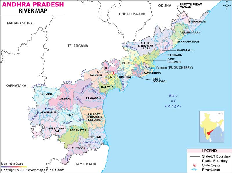
List of Rivers in Andhra Pradesh
| River Name | Length (Kilometers) | Origin | Sets Off |
|---|---|---|---|
| Krishna | 1,400 | Mahabaleshwar Plateau, Maharashtra | Bay of Bengal, Andhra Pradesh |
| Godavari | 1,465 | Brahmagiri, Maharashtra | Bay of Bengal, Andhra Pradesh |
| Tungabhadra | 531 | Western Ghats, Karnataka | Krishna River, Andhra Pradesh |
| Penna | 597 | Nandi Hills, Karnataka | Bay of Bengal, Andhra Pradesh |
| Vamsadhara | 254 | Eastern Ghats, Odisha | Bay of Bengal, Andhra Pradesh |
| Nagavali | 160 | Eastern Ghats, Odisha | Bay of Bengal, Andhra Pradesh |
| Bahuda | 115 | Eastern Ghats, Odisha | Nagavali River, Andhra Pradesh |

Krishna River (1,400 kilometers):
The Krishna River, one of India’s major rivers, is a geographical marvel that profoundly influences the Deccan Plateau’s landscape, climate, and socio-economic fabric. Stretching over 1,400 kilometers, the river originates from the pristine Mahabaleshwar plateau in Maharashtra, located at an elevation of approximately 1,300 meters above sea level. Its journey through the Deccan Plateau encompasses a diverse range of geographical features, contributing to the region’s vitality.
As the Krishna River meanders through Maharashtra, it embraces the rugged Western Ghats. Here, the river’s source, often referred to as the ‘Krishna’s Mouth,’ is a serene spring surrounded by lush forests. This region not only acts as the river’s birthplace but also as a critical water catchment area for the entire basin. The forests play a pivotal role in maintaining the river’s flow by regulating rainfall and facilitating groundwater recharge.
Leaving the Ghats, the Krishna River enters the Deccan Plateau, where it encounters a predominantly semi-arid landscape. In this geographical transition, the river takes on a crucial role as a lifeline. The fertile Krishna Delta, formed by the river’s deposits and sedimentation, is an agricultural heartland. The river’s waters are meticulously harnessed through an intricate network of canals and reservoirs, facilitating extensive irrigation. Notably, the Nagarjuna Sagar Dam, one of the world’s largest masonry dams, exemplifies human ingenuity in managing water resources.
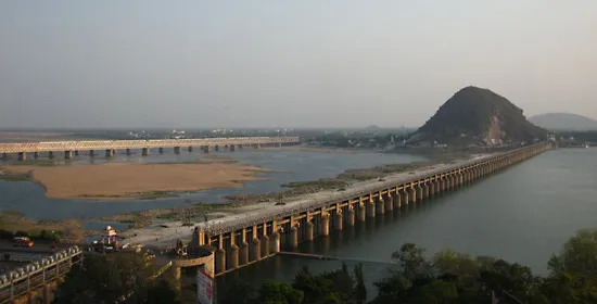
The geography of the Krishna River basin also influences the climate of the Deccan Plateau. Its flow and the associated monsoon patterns dictate the region’s agricultural calendar. The river basin’s varying topography, from the Western Ghats’ forests to the vast plains, results in diverse microclimates and vegetation. This ecological diversity not only sustains agriculture but also supports a rich biodiversity.
In conclusion, the Krishna River serves as a geographical and hydrological linchpin in the Deccan Plateau. Its origins in the Western Ghats, journey through the semi-arid plains, and vital role in agriculture underscore its significance. The river’s influence extends beyond its waters, shaping the region’s ecology, climate, and socio-economic activities, making it a captivating subject for geographical exploration.
Godavari River (1,465 kilometers):
The Godavari River, often referred to as the “Ganga of the South,” is one of India’s most prominent and sacred rivers. With a length of approximately 1,465 kilometers, it is the second-longest river in India after the Ganges. The Godavari’s journey begins in the Brahmagiri hills of Maharashtra, where it is fed by the holy Nasik and Trimbak rivers. It traverses across multiple Indian states, including Maharashtra, Telangana, Andhra Pradesh, and Chhattisgarh, before finally emptying into the Bay of Bengal in Andhra Pradesh.
The Godavari holds a revered place in the hearts of millions of Indians due to its cultural, religious, and geographical significance. The river’s basin, known as the Godavari Basin, is one of the country’s largest and is critical for agricultural activities. The fertile plains surrounding the Godavari are agriculturally rich, making it a prime contributor to India’s food production.
The river plays a pivotal role in the lives of the people residing along its banks. It is not only a source of sustenance but also a sacred entity. The Godavari hosts numerous religious festivals and ceremonies, with the Pushkaram festival celebrated every twelve years drawing massive crowds of devotees seeking to cleanse their sins by taking a dip in its holy waters.
Geographically, the Godavari Basin is characterized by diverse landscapes. It encompasses lush forests, rolling hills, and fertile plains. The river’s flow is erratic, with heavy monsoon rains causing it to swell significantly. In contrast, during the dry months, its flow reduces, revealing vast sandbars.
Moreover, the Godavari is also vital for the region’s biodiversity. The lush Godavari Delta serves as a habitat for various bird species, while the river’s waters support a diverse aquatic ecosystem.
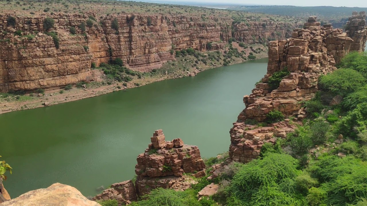
Tungabhadra River (531 kilometers):
The Tungabhadra River, with its origins nestled in the Western Ghats of Karnataka, weaves a tale of geographical significance and ecological importance. Spanning approximately 531 kilometers, it courses through the Deccan Plateau, charting a path that touches the heart of southern India.
Originating from the pristine hills of the Western Ghats, the Tungabhadra meanders through the rocky terrain of the Deccan Plateau, shaping the landscape along its way. Its journey encompasses the districts of Bellary and Raichur in Karnataka, and ultimately, it merges with the mighty Krishna River in Andhra Pradesh’s Alampur.

This river is more than a geographical feature; it’s a lifeline for the regions it traverses. The Tungabhadra plays a pivotal role in irrigation, fostering agricultural practices in the otherwise arid expanse of the Rayalaseema region in Andhra Pradesh. Its waters are harnessed through a system of reservoirs and dams, including the renowned Tungabhadra Dam. This engineering marvel not only provides water for irrigation but also generates hydroelectric power, contributing to the region’s energy needs.
Ecologically, the Tungabhadra River and its surrounding habitat are home to a rich diversity of flora and fauna. The riverbanks teem with lush vegetation, providing a habitat for various bird species and aquatic life. Additionally, the rocky outcrops and boulders along its course have geological significance, offering insights into the Deccan Plateau’s geological history.
Penna River (597 kilometers)
The Penna River, coursing through the southern part of Andhra Pradesh, is a lifeline in an otherwise arid landscape. With a length of 597 kilometers, it originates in the Nandi Hills of Karnataka and flows eastward before emptying into the Bay of Bengal. Its journey encompasses a variety of geographical features and ecological significance that make it a vital part of the region.
As it meanders through Andhra Pradesh, the Penna River assumes the role of an agricultural savior. The river facilitates irrigation in the districts of Anantapur, Kadapa, and Nellore, transforming arid terrains into fertile fields. Farmers have harnessed its waters to cultivate a range of crops, contributing significantly to the state’s agricultural output.
The estuary of the Penna River forms the picturesque Pulicat Lake, the second-largest brackish water lagoon in India. This critical ecosystem serves as a sanctuary for diverse bird species, making it a haven for ornithologists and nature enthusiasts. Additionally, the region surrounding the river has a rich biodiversity, with a unique blend of flora and fauna adapted to its semi-arid climate.
Understanding the Penna River is not just a lesson in geography but also a glimpse into the intricate relationship between water resources, agriculture, and the environment. It showcases how a river can be both a source of sustenance and a hub of biodiversity in a region challenged by water scarcity.
Other Rivers in Andhra Pradesh
Vamsadhara River (254 kilometers)
Originating in the Eastern Ghats, the Vamsadhara River flows through the districts of Srikakulam and Vizianagaram before entering Odisha. This river is instrumental for irrigation and sustains agriculture in the northern part of Andhra Pradesh.
Nagavali River (160 kilometers)
Like the Vamsadhara, the Nagavali River also originates in the Eastern Ghats. It flows through Srikakulam and Vizianagaram districts before merging with the Bay of Bengal in Odisha. Its waters are utilized for agriculture and fishing.
Bahuda River (115 kilometers)
This smaller river in Srikakulam district is a tributary of the Nagavali River. It significantly contributes to the region’s irrigation needs and groundwater recharge.
These rivers, with their diverse geographical features and roles, have shaped the culture, economy, and ecosystem of Andhra Pradesh. They have witnessed the rise and fall of dynasties, the growth of agriculture, and the sustenance of countless communities. For students, understanding the vital characteristics of these rivers is crucial not only for geographical knowledge but also for appreciating the profound impact of water resources on human civilization.